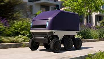
AMR performance depends on how well the model understands space, motion, terrain, and risk across changing environments. iMerit helps robotics perception teams turn camera, LiDAR, radar, GNSS, IMU, odometry, and robot log data into high quality ground truth for object detection, terrain segmentation, sensor fusion, SLAM, path planning, and model evaluation. Our workflows support the hard parts of AMR autonomy: sensor noise, class ambiguity, occlusion, localization drift, dynamic agents, mixed terrain, rare obstacles, and edge cases that standard datasets miss.
USE CASES
OBJECT DETECTION AND OBSTACLE CLASSIFICATION
Label people, vehicles, carts, and unexpected objects that affect AMR movement and safety.
TERRAIN SEGMENTATION AND TRAVERSABILITY
Segment drivable surfaces, curbs, slopes, and blocked paths so models understand where the robot can move.
PATH PLANNING AND FREE SPACE LABELING
Create ground truth for free space, route corridors, no go zones, and local navigation decisions.
SLAM AND MAPPING SUPPORT
Annotate landmarks, static structures, and localization risk zones to support SLAM, map validation, and robot localization.
EDGE CASE MINING
Identify and label hard scenes such as glare, rain, occlusion, and sensor dropouts for retraining and regression testing.
SENSOR FUSION GROUND TRUTH
Align camera, LiDAR, radar, and robot telemetry to improve depth reasoning, object tracking, and safety envelope modeling.
We offer end-to-end data labeling solutions across a wide range of data types and modalities:
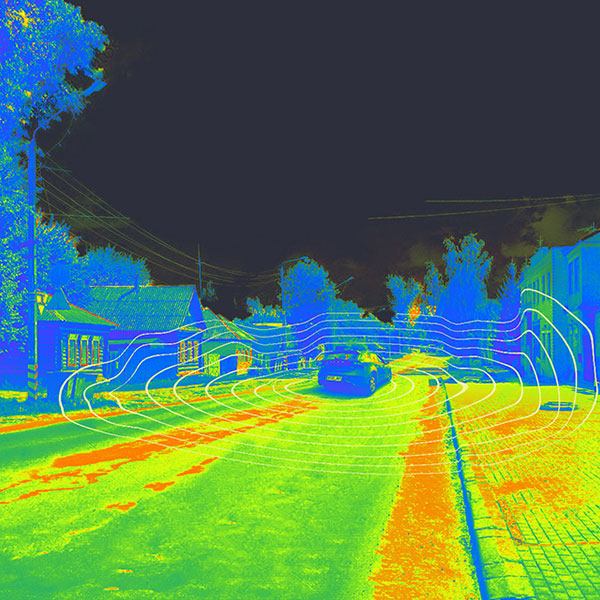
Multi-sensor Fusion
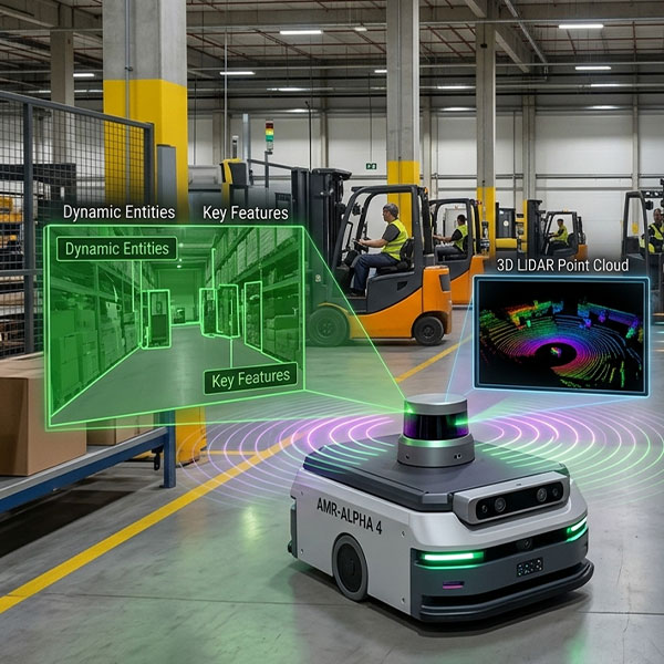
iMerit teams align and annotate synchronized camera, LiDAR, radar, and telemetry data, supporting AMR use cases such as obstacle detection, depth reasoning, localization, sensor validation, and safety envelope modeling.
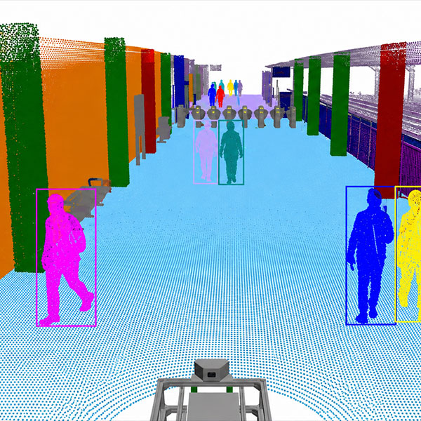
PanOptic Segmentation
iMerit teams annotate both class labels and object identities at the pixel level, helping AMR models understand terrain, free space, dynamic agents, static infrastructure, and scene context in one unified view.
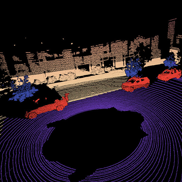
3D point Clouds
iMerit teams annotate LiDAR point cloud data with spatial labels, cuboids, segmentation, and attributes, supporting 3D perception, obstacle localization, terrain mapping, and sensor fusion workflows.
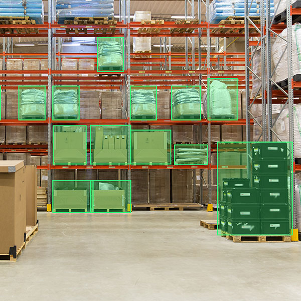
Bounding boxes
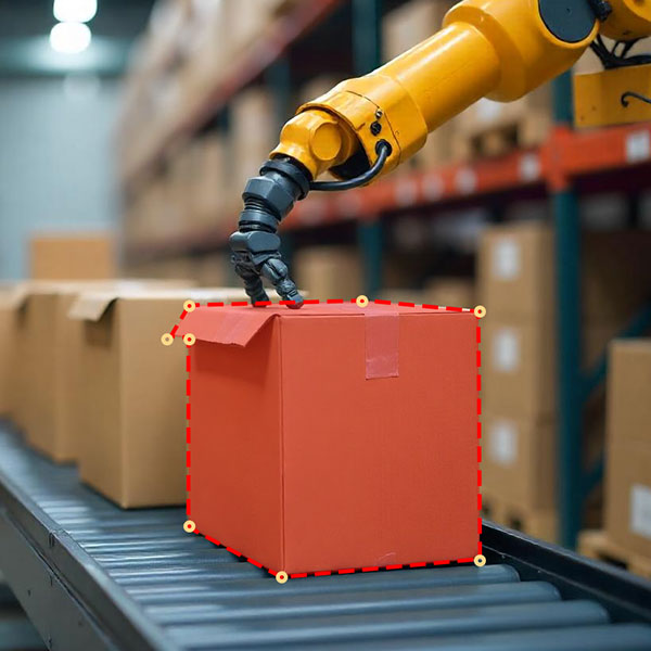
iMerit teams annotate objects in images and video with precise rectangular labels, supporting AMR use cases such as pedestrian detection, vehicle detection, pallet detection, equipment detection, and rare obstacle discovery.
Polygon Annotation
iMerit teams annotate precise object and region outlines in images and video, supporting use cases such as blocked path detection, terrain boundary labeling, work zone mapping, vegetation labeling, and irregular obstacle detection.
Semantic Segmentation
iMerit teams annotate class labels at the pixel level, helping AMR models distinguish terrain, free space, pedestrians, obstacles, vegetation, and static infrastructure for dense scene understanding.
Keypoint annotation
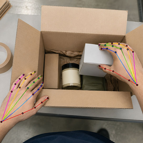
iMerit teams annotate precise spatial landmarks in images and video, from human pose and hand landmarks to docking targets, pallet corners, machine reference points, and robot interaction zones.
scene classification
iMerit teams tag images, frames, and clips with scene level context such as terrain, lighting, weather, visibility, site type, traffic density, and edge case conditions for cleaner dataset slicing and model evaluation.
BENEFITS
AMR labels should map to model decisions. iMerit helps define object classes, terrain classes, free space logic, safety zones, route intent, dynamic agent types, and task specific attributes that support perception and planning models.
Quality Workflows:
High quality AMR data requires consistency across frames, sensors, annotators, and environments. iMerit uses structured QA, expert review, consensus workflows, sampling audits, and annotation guidelines to reduce label noise.
Temporal Consistency Across Sequences:
Outdoor robots move through scenes over time. iMerit supports sequence based annotation for tracking, occlusion recovery, dynamic object movement, route continuity, and frame to frame consistency.
Feedback loops for Active Learning:
Model predictions can be reviewed, corrected, ranked, and converted into new training data. This helps teams prioritize high value samples, rare cases, and model failure modes.
Edge Case Taxonomies:
Hard scenes can be tagged by environment, weather, lighting, sensor condition, object type, terrain risk, localization issue, and model error. This gives ML teams better control over retraining and regression testing.
Multimodal Workflows:
iMerit supports camera, LiDAR, radar, GNSS, IMU, odometry, map data, and robot logs in synchronized annotation workflows for perception, localization, and planning teams.
Designed for real-world deployment, Our annotation workflows support robotics systems operating in dynamic environments, handling edge cases, multi-modal data, and real-time constraints at scale.
household
Perception, navigation, and obstacle avoidance in dynamic indoor environments for tasks like cleaning and object detection.
The client needed to scale annotation and validation across product recognition, OCR, inventory intelligence, and quality assurance while maintaining high accuracy across diverse store layouts, lighting conditions, packaging variations, occlusions, and changing product assortments. The program also required retail domain expertise, structured quality processes, and the flexibility to support evolving workflows and new AI use cases.