Autonomous Tractors
MODEL READY DATA FOR PERCEPTION, NAVIGATION, AND IMPLEMENT AWARE AUTONOMY
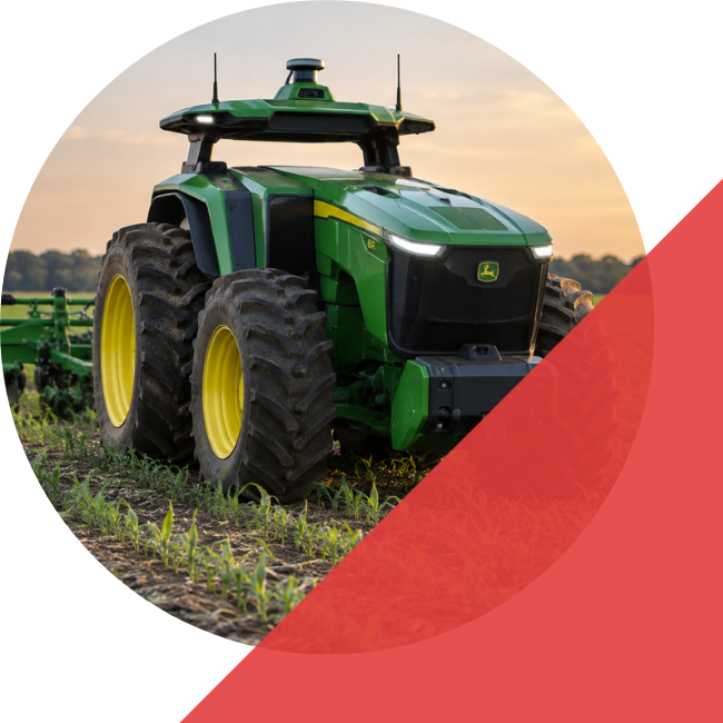
Data Built for FIELD AUTONOMY
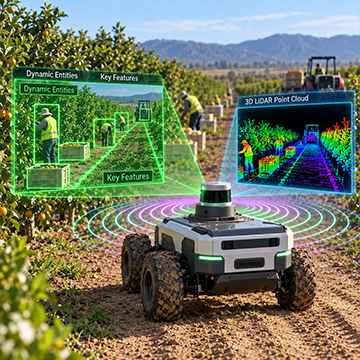
Autonomous tractors need models that can understand crop rows, terrain, obstacles, implements, and route intent across changing field conditions. iMerit helps robotics perception teams turn camera, LiDAR and radar into high quality ground truth for autonomous tractor perception, navigation, path planning, and safety validation. Our workflows support the hard parts of field autonomy, including dust, glare, occlusion, irregular rows, muddy terrain, vegetation density, localization drift, rare obstacles, and implement movement.
USE CASES
AUTONOMOUS NAVIGATION
Training data for crop row following, field boundary detection, free space detection, route corridors, obstacle avoidance, safe stop zones, and headland turns.
PRECISION SPRAYING
Annotation for crops, weeds, no spray zones, plant stress, growth stage, crop damage, vegetation density, and treatment sensitive areas.
TILLAGE AND PLANNING
Labels for row structure, soil texture, field coverage, path alignment, implement zones, terrain changes, and route consistency.
MOWING AND MATERIAL HANDLING
Ground truth for drivable paths, object proximity, loading points, clearance zones, equipment movement, and work area boundaries.
FLEET AND REMOTE OPERATIONS
Data support for site context, geofence regions, route validation, unusual events, safety alerts, and remote monitoring review.
SIMULATION AND VALIDATION
Scenario labels, field condition tags, rare event datasets, benchmark slices, regression sets, and model output review for continuous validation.
Capabilities
Multimodal Sensor Fusion
Camera, LiDAR, radar and machine data aligned into consistent ground truth for field perception models.
Terrain and Traversability Segmentation
Labels for soil, mud, ruts, slopes, crop rows, vegetation, water, debris, ditches, free space, and no go zones.
Navigation and Route Intelligence
Annotations for row following, field boundaries, headlands, turn zones, route corridors, safe stop areas, and path constraints.
Obstacle and Safety Labeling
Labels for people, animals, vehicles, implements, rocks, branches, irrigation pipes, fences, gates, tools, debris, and occluded hazards.
Implement Aware Perception
Labels for attachments, hitch areas, tool sweep zones, clearance risk, equipment proximity, and task specific operating regions.
Edge Case Mining
Identification of hard scenes such as dust, glare, rain, night operation, dense vegetation, damaged rows, standing water and unusual obstacles.
annotation TYPES FOR AUTONOMOUS TRACTORS
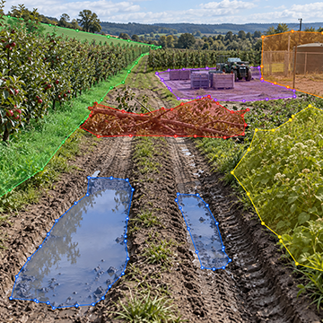
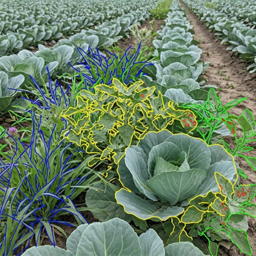
POLYGON ANNOTATION
Precise outlines for irregular objects and regions such as field edges, blocked paths, puddles, ruts, vegetation, work zones, and restricted areas.
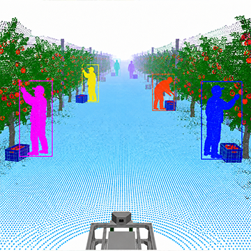
PanOptic Segmentation
Class level masks combined with individual object identities for a unified view of plants, terrain, equipment, obstacles, and dynamic agents.
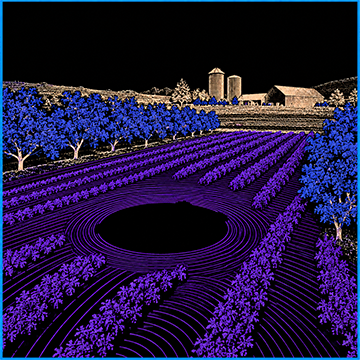
3D point Clouds
LiDAR based spatial labels, cuboids, point segmentation, and attributes for obstacle localization, terrain geometry, ground planes, and sensor fusion workflows.
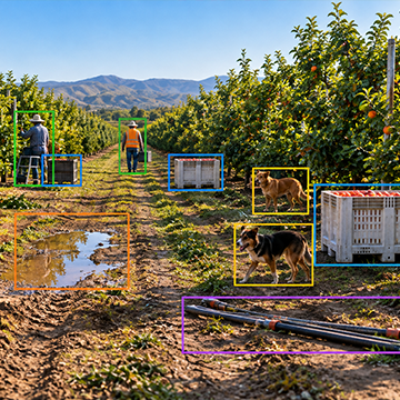
Bounding boxes
Rectangular labels for workers, animals, vehicles, implements, rocks, tools, irrigation pipes, gates, debris, fruits and other field obstacles that affect tractor movement.
PolYLINE Annotation
Line based labels for crop rows, furrows, field boundaries, path edges, route guides, fence lines, and operating corridors.
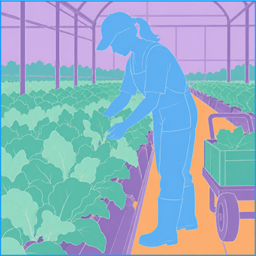
Semantic Segmentation
iMerit teams annotate class labels at the pixel level, helping AMR models distinguish terrain, free space, pedestrians, obstacles, vegetation, and static infrastructure for dense scene understanding.
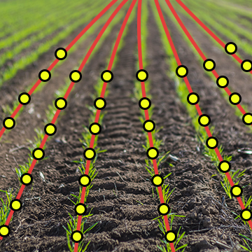
Keypoint annotation
Precise landmarks for implement reference points, hitch areas, row markers, docking targets, machine interaction zones, and other spatial cues.
scene classification
Scene level tags for crop stage, soil condition, lighting, weather, visibility, terrain type, field task, sensor condition, and edge case review.
BENEFITS
- Ontologies Built Around Field Behavior: iMerit helps define crop classes, obstacle classes, terrain states, safety zones, route intent, implement regions, and task specific attributes that support perception and planning models.
- Quality Workflows That Scale: Structured QA, expert review, consensus workflows, sampling audits, and annotation guidelines help reduce label noise across sensors, fields, and operating conditions.
- Temporal Consistencies Across Sequencies: Sequence based review supports object identity, occlusion handling, frame consistency, sensor alignment, route continuity, and model behavior analysis across video and LiDAR data.
- Edge Case Taxonomies: Hard scenes can be tagged by crop type, terrain risk, weather, lighting, sensor condition, localization issue, obstacle type, implement state, and model error.
- Multimodal Tractor Workflows: iMerit supports camera, LiDAR, radar, map data, and machine logs in synchronized workflows for perception, localization, and planning teams.
- Feedback Loops For Active Learning: Model predictions can be reviewed, corrected, ranked, and converted into higher value training data for rare cases, model gaps, and failure modes.
WHY WORK WITH US
AGRONOMY EXPERTISE
Specialized teams understand field sensors, crop row structure, terrain classes, implement zones, obstacle ambiguity, occlusion, and edge cases that affect model performance.
Technology and Automation
Ango Hub supports image, video, LiDAR, point cloud, cuboids, segmentation, attributes, review queues, QA checks, issue tracking, analytics, and workflow automation.
Secure Data Operations
Controlled environments, role based access, audit trails, encrypted data handling, and compliance led delivery help protect sensitive machine, site, sensor, and geospatial data.
CASE STUDY
iMerit helped an agricultural AI team improve crop and weed detection by delivering expert image annotation across complex field imagery. The team annotated and reviewed millions of images across 40+ crop types, handling challenges like overlapping vegetation, variable lighting, and visually similar crops and weeds, while maintaining 98.42% accuracy to improve model performance in real-world farm conditions.
Featured
Content
GET
STARTED!
Better Data for Autonomous Tractor Models
iMerit helps teams build high quality datasets for perception, sensor fusion, terrain understanding, crop row detection, implement awareness, obstacle avoidance, and safety validation.